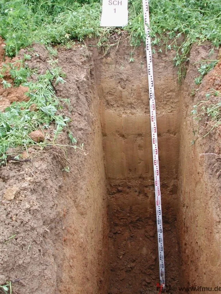
If you’ve worked on sites near the Willamette River’s floodplain and then moved up into the South Hills, you already know the subsurface story changes completely within a couple of miles. The flat, silty deposits around Alton Baker Park bear little resemblance to the stiff, sometimes gravelly colluvium weathered from the Eugene Formation up on Fox Hollow. In our experience, an exploratory test pit is the fastest way to see that transition with your own eyes — logged directly from the excavation wall. We use test pits to map fill thickness, identify buried organics, and decide whether a quick proctor test is enough or if we need to pair observations with a grain-size analysis for classification under ASTM D2487. When the excavation stays open, the conversation with the contractor gets real about groundwater seepage and stand-up time, and that’s exactly the kind of practical data a boring log alone doesn’t capture.
An open test pit gives you the one thing a drill rig cannot — a continuous, full-scale view of stratification, seepage, and excavation behavior in real time.